CROYDON COMMENTARY: London’s Tory Mayor Boris Johnson, with Labour-run Croydon Council and through Transport for London, has earmarked more than £100 million for road schemes and to re-configure the tram system in the town centre, all for the sake of the Westfield and Hammerson redevelopment. VALERIE HUNTER has scoured the published planning documents and predicts traffic misery ahead

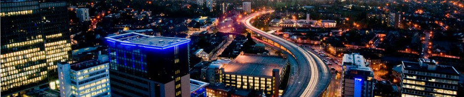
Shape of things to come: the plans for Westfield could make queuing in the underpass routine
The council, the developers and speculators, the Mayor of London and Transport for London, the local MPs and various vested interests all speak warmly of “regeneration”. But what do the various schemes being proposed for Croydon actually mean for our future?
Reviewing the various proposals being put forward, the consequences could include:
- 9,000 new homes in the centre of Croydon, most with private parking, and mostly in the side roads to Wellesley Road, with minimal other access from the south for the cars, service and delivery vehicles for large and heavy items, which together with deliveries for present and future hotels, offices, restaurants and shops, will ensure lots more traffic on Wellesley Road.
Wellesley Road – west side
Amalgamate lanes to provide a central reservation, a so-called “greening”, which will delay buses. Any additional “greening” will probably be killed by the traffic exhaust pollution.
- Placing the entrance to the Westfield complex so close to the underpass north-bound exit will cause buses to stop to let the cars and all delivery vehicles go into the complex from the underpass. This will either cause a long queue of buses and other traffic on the surface, possibly even back to the George Street junction, or possibly even queues of vehicles in the underpass on those occasions when the surface traffic is given the right-of-way.
- Any queue past the George Street junction could affect buses from the south turning into George Street (east) to go to East Croydon Station.
- Placing the southern exit from the shopping centre in the same place will stop all buses and other surface traffic for longer and all vehicles heading northwards (towards the 9,000 flats, hotels, restaurants etc) in the underpass.
- This stopped traffic will block all vehicles behind it in the underpass that want to go into the shopping centre. So far no solution from TfL or the council has been suggested to resolve this blockage in the underpass.
- This could result in queuing traffic all the way back to the gyratory and more queuing on the flyover.
- Remove the Lansdowne Road-to-Whitgift Centre subway which takes pedestrians safely non-stop from one side of a six-lane urban motorway to the other.
- Replace the subway with a pedestrian crossing there for the crowds of passengers disembarking from 20 bus routes on both sides of the road, a tram stop, (and the new tram “loop” stop), the East Croydon Station bridge, the new homes (No1 Lansdowne alone proposes 900 flats), the hotels and restaurants, and the new shopping complex, which will cause long delays for traffic while these pedestrians cross.
- Queuing also anticipated at Wellesley Road junctions and Wellesley Road itself.
- Buses stopped at Poplar Walk, not just briefly to let out six bus routes and some cars, but additionally to let cars from the north cross their path to go into the shopping complex.
Roads to Wellesley Road – west side
- The queuing on Park Lane, sometimes nearly back to the gyratory, will affect buses as well as other vehicles.
- Queuing on the Flyover will delay the buses there, too. All the prospective traffic queuing discussed here is mentioned in Croydon’s report on Westfield planning.
- Four traffic lanes proposed in Boris’ new bridge on the A232 at the Purley Way, which will require substantial building on Duppas Hill Park, but which will create another bottleneck, where Duppas Hill Road meets with Stafford Road and Epsom Road, causing congestion for buses and other traffic here.
- There’s an expected increase in traffic at the A232/A23 junction, with no solution suggested to this in the Boris flyover plans. It must be assumed that additional traffic near Fiveways will cause further delays for all traffic, including buses, both on the Croydon Road, and Purley Way.
- Proposed replacement of a bus lane by a cycle lane on Stafford Road will delay buses that use that road, as they will have to share the single lane remaining with cars.
- Both Stafford Road and Purley Way will also have a considerable amount of additional traffic from the south, going to the new shopping centre. This is likely to create more delays for bus routes on these two roads.
Boris, TfL and Croydon Council are continually advocating that people should use public transport to come into Croydon, but the new flyover proposed only increases roads for cars.
Nowhere in all the plans is there any mention of additional bus routes or services to bring people from south-west London, in an effort to persuade people to reduce their car use.

Fantasy future: This is how Westfield’s artists foresee George Street. Notice anything missing? Yes, traffic, and with the road changes proposed, there’s likely to be plenty more traffic on the roads in central Croydon
Roads to Wellesley Road – east side
- “Loop” trams from East Croydon Station turning into Dingwall Road will stop vehicles at that George Street junction for longer.
- Vehicles for this large eastern area, whose only other entrance is via Bedford Park, unable to turn into Dingwall Road at the same time as the “loop” trams, will also hold up buses going to East Croydon Station, trapped behind them in the single lane. Some, but not all trams, as well as cars crossing one of the most used pedestrian crossings in Croydon on the corner of Dingwall Road are a hazard to the pedestrians.
- As these trams will need the whole of Lansdowne Road to make the turn into Wellesley Road, buses will need to be re-routed down to George Street junction instead. This results in passengers unable to get on or off buses in Dingwall Road, and having to do this at the congested bus stand by the railway station instead. This very busy area, noted for its long delays caused by congestion and phasing of traffic lights, is likely to become busier and yet more congested.
Wellesley Road – east side
- Buses delayed at Bedford Park junction due to traffic congestion with queue of cars waiting to turn into Poplar Walk.
- Buses stopped by pedestrian crossing in lieu of subway just south of Bedford Park.
- Buses stopped by trams (on the new loop) making wide turn out of Lansdowne Road, and then crossing back to the pavement side of Wellesley Road.
- Buses stopped by thousands of people on the pedestrian crossing – details as for Wellesley Road west side – also including the passengers from the “Loop” trams.
All of the consultation documents are very insular, considering just the scheme which they propose, but not the knock-on effects elsewhere – particularly the bus services, which bring people into Croydon from so many directions. One thing is consistent in all the plans, from Croydon Council (Tory and Labour), TfL and Boris: the car is given priority.
When Connected Croydon conducted its over-priced paving works in South End, there was a year’s worth of disruption for relatively small-scale roadworks. Now, central Croydon faces years of traffic disruption by roadworks, not just to altering a few paving slabs, but to instal new and altered traffic lights, roads, new pedestrian crossings, new flyovers, and closure of subways, all after lip-service consultations.
All this will come at enormous expense to residents, public transport users and Council Tax-payers.
For what? Traffic gridlock and exhaust pollution.
- £85m TfL road schemes include flyover to Croydon Flyover
- TfL’s £48m loop schemes could break the link in Tramlink
- Boris Flyover to cost more than Mayor’s annual bike spend
- Inside Croydon Events: for dates and links to what’s happening in and around Croydon, updated daily, click here
-
Inside Croydon: Named among best regional media campaigns, 2014.
- Croydon’s only independent news source, based in the heart of the borough: 729,297 page views in 2014.
- If you have a news story about life in or around Croydon, a residents’ or business association or local event, please email us with full details at inside.croydon@btinternet.com

The misconceived Hammersfield scheme is having a predictable knock on effect: everything connected with it is a ****up and everything eventuating from it will be a disaster, financially and socially. Mark my words. You read it here first ( or, if not first, most frequently).
Lots here and I can’t claim to have read it all properly but one thing jumps out at me:
“Four traffic lanes proposed in Boris’ new bridge on the A232 at the Purley Way”
It was two lanes in the “artists impressions” provided at consultation.
Also, providing that much private car parking for people living 1 minute walk from East Croydon station is inexcusable. More progressive boroughs wouldn’t dream of putting anything beyond car club/ disabled parking for an area with such extraordinary access to public transport.
“More progressive boroughs wouldn’t dream of putting anything beyond car club/ disabled parking for an area with such extraordinary access to public transport”
If people who live in the new Whitgift flats don’t have cars how will the drive out to Purley Way?
Is that a serious question?
No
A good summary by Valerie and it is going to be very challenging to manage the traffic both during construction and after. There is also the issue of the sub standard capacity of bridges over the railway on the A222 which unless improved will mean that heavy construction traffic can only access from south of Hammersfield.
Not that long ago Croydon Planners/Urban Designers were promoting schemes (including an International Design Competition) to reduce the carriageway area of Wellesley Road and create something like Las Ramblas from Barcelona. I assume those ambitious and quite frankly undeliverable ideas have been “parked” particularly as they are not compatible with Hammersfield.
Kristian is correct that two lanes were shown for the Boris bridge but there would also be another two for on/off slip roads at its eastern end.
I remain a supporter of the need to do something (redevelop?) with the Whitgift but the challenge, to which I see no practical solutions being offered, is the resultant road traffic.
You could make a start by flattening the Purley Way Sainsbury’s in favour of a park and ride facility using the tram stop there. Get Hammersfield to pay for a couple of dedicated trams running round the loop and back to their own platform?
Yeah, I’m sure all the thousands of local residents who live around there, with nowhere else to buy essentials, would be delighted! Maybe they could join the traffic queues along the Brighton Road and go into Croydon to pay extortionate parking fees, and pollute the environment at the same time. Brilliant. Stand for Local Government next time, you’d win!!!
Brilliant article. It shows the lack of foresight by the previous Tory run Council in the first instance. How can Westfield ever work with the volume of people that will descend on the place. Obviously roads will need to be re-designed, but how? There is simply not enough space and these proposals look disastrous. The Council must understand that 90% of people visiting shopping centres like Westfield will do so in their cars. Let’s face it, it’s not much fun taking a flat pack home on the bus or tram! Now then, think about all the articulated lorries who will be delivering the flat packs to the stores “in bulk”, in the first place. These proposals ratify my recent comments regarding the 20mph hour speed limit in Croydon that so many people are getting steamed up about, but for all the wrong reasons (and you didn’t hear this first by Arno Rabinowitz).
Well done!
I brought a bit of this topic up at the CPO Enquiry. Specifically 1) How many lorries will it take to cart the Whitgift Centre away? Er, thousands! and 2) You can’t do this transport in the mornings because Lower Addiscombe Road and St James’ Road are clogged, as well as roads to Brighton and Wimbledon.
I’m also concerned about gridlock around East Croydon Station during the Royal Mail re-construction. Things are already tightly squeezed around there and trams are starting to bunch up, thereby blocking traffic across Cherry Orchard Road.
You do have to wonder how much caution is being thrown to the wind to satisfy the needs of developers in town.
Reblogged this on LondonBiz WordPress Blog.
I forgot to say that I thought Valerie Hunter’s article was a superb analysis of the forthcoming traffic chaos. Well done! It needs to be much more widely publicised.
Valerie Hunter’s detailed analysis of the issues emanating from the desire to re-configure the use of the road systems in Central Croydon to accommodate a needless tram “loop”, as well as the access and egress of the proposed Westfield Centre, have focused on the disruption to existing traffic patterns, and more importantly, to the TfL bus operations.
The recent public consultation insisted that only the physical effects of the proposed new loop should be commented upon at this time, but two co-related issues should be aired publicly now :- (a) an escalation of project costs which, until they reach £30 million, the Croydon Partnership (Westfield/Hammerson), will not have to bear a greater share of (are the victims here Croydon ratepayers?); and (b) the horrendous increase in pollution and decrease in Air Quality caused by the consequences of the changed traffic management proposals.
Of these two issues, that of Air Quality is by far the more important from a public health aspect. However, the Environmental Impact Assessment (EIA) of, not only the Tramlink ‘loop’, but of the effects of the A232 flyover at Duppas Hill/ Fiveways Corner proposal is going to be presented at the end of 2015, concurrently with the physical proposals of the project, without the benefit of proper monitoring evidence of the two main sources of pollution which affect the air quality around Croydon, Nitrogen Dioxide (NO2), derived primarily from emissions from road transport, and Particulate Matter (PM10), derived from exhaust emissions and wear, tyre and brake wear and emissions from machinery. [ It is worth pointing out that Trams themselves are polluters in that they create dust and other particulates by the simple expedient of wheel and track abrasion on corners and with braking. More Trams, more dust etc].
The annual mean limit of NO2 and PM10, 40 microgrammes per meter cubed, is measured at three monitoring points in Croydon; Beulah Junior School, Thornton Heath, London Road, Norbury and George Street Croydon. Although London Road is by far the most affected by NO2 emissions, the last mentioned site, George St. also exceeds the limit (46).
The 2013 GLA publication “Air Quality in Croydon” identifies five areas within the Borough for improvements (see map on page 9 of the report). The three air quality sites mentioned above are shown thereon by red stars. However, the map also shows an air monitoring site at Fiveways Corner which presents, curiously, no information at all. One hopes that efforts will be made to make use of this site, if it actually exists, in support of the promised EIA.
The monitoring site at London Rd. Norbury is the only one where the relationship between NO2 emissions and the vehicles responsible are compared. A similar comparison should immediately be initiated at the George St. site because the re-routing of South-bound traffic from Landsdown Rd./Dingwall Rd. as part of a traffic option in Option 1, and diverting it along Wellesley Rd. will surely create significantly more NO2 emissions. Add to that the increased amount of vehicle idling and braking between Landsdown Rd. and George St., plus new traffic lights to allow access and egress from and to the new Westfield Centre and a major diminution of air quality will be created.
The modifications at the junction at East Croydon and Dingwall Rd. will create additional pollution because of the Tram curves (PM10) and the stopping and starting of additional vehicles at the traffic lights (NO2 and PM10) yet there seems to be no monitor of any sort in place where a base line could be established to compare the existing traffic emissions with those generated by modelling. Why not?
In view of Mayor Boris Jonson’s concern at the increase in levels of PM10 pollutants, as reported in the Evening Standard some days ago I am less than enthusiastic about the potential of a similar rise in Croydon, particularly as the GLA’s 2013 report on Air Quality in Croydon contains so many places where important statistics have been omitted. Since that report was based on many sources, primarily I suggest, from the London Borough of Croydon itself, I think the Council has much to correct and explain before the public are presented with another proposal to comment upon.
Perhaps a Public Inquiry should be established, which would embrace ALL the interlinked TfL projects now being considered at great expense in this Borough.
Not just disruption and heavy vehicle pollution from the Whitgift Centre demolition/reconstruction – but road works too –
– Underpass closed for ‘re-profiling’ by Westfield – i.e. change in gradient required to make the new road layout work.
– Underpass closed to create new vehicle exit from Westfield car park across Wellesley Road to go down underpass.
– Creating new pedestrian crossings across Wellesley Road, with or without central reservation (apparently undecided).
– New or altered traffic lights associated with all the above.
But WORSE will be the Tram Loop Construction results –
– Road closures and reduction of lanes on BOTH sides of Wellesley Road, Lansdowne Road, George Street, and Dingwall Road
(construction planned to begin in Spring 2017 and completing in Mid 2019) :
– Compulsory purchase of land on west side of Dingwall Road to construct the tram lane :
– Tram curve cutting through half the pavement by pedestrian crossing to East Croydon Station at Dingwall Road junction :
And to a lesser extent, road and pavement works including :
– Removal of central pedestrian island at Lansdowne Road western exit for tram curve.
– Removal of steps to subway for same tram curve.
– Digging up pavement in Lansdowne Road for new tram stop.
– Numerous new and altered traffic lights associated with the tram loop proposals.
‘The main purpose’ of the Tram Loop is stated to be to accommodate the potential impact of the ‘Whitgift Centre’.
So this ‘short-term’ plan for an increase in tram capacity, together with the car parks access/exit plans, will turn Central Croydon into a building site for many years !
Actually think that most people who have any idea about the Hammersfield development were already prepared for central Croydon being a building site for the rest of this decade.
But what is most concerning is not a temporary inconvenience. It is that many millions of public money is about to spent, at the behest of Westfield (and Hammerson, too), to construct a traffic system which will result in more cars on our roads, more congestion, more deadly pollution and a worse public transport system, and which will be a legacy of the shopping mall development possibly for generations afterwards.
Is it proposed to “reprofile” the underpass? I was not aware of this. If my memory is correct that will not be easy given the way it is constructed.
David, re-profiling of the northern end of the underpass was mentioned in the Council Strategic Planning Committee Minutes on 25th November, 2013 – A103/13 – 6.1 Whitgift Redevelopment Report Page 77 – 8.160..
I asked the Council more than once (!) what this meant and what was involved, and received no response to this question.
I asked again at the recent ‘consultation, and the above ‘change in gradient’ reply was the answer received.