
This is an old coal tax post, found at the entrance to Little Farleigh Common, one of many boundary markers around Croydon
Over the course of lockdown, one intrepid geographer has managed to complete the ‘beating of the bounds’ and discover the fascinating history of our parish and civic boundaries, stretching back to Saxon times.
Words, pictures and mapping by Dr BEN CLIFFORD
It started with a walk in the first lockdown to Selsdon Woods, where a path was signposted as “Addington Border”. This piqued my interest. I checked some historical maps and the path did indeed follow the traditional borders of Addington Parish.
As a geographer, I’ve always found boundaries interesting. Boundaries are important in terms of understanding where we are, relating to questions of place identity and how we carve up territory in order to govern it.
Eight months later, in the third lockdown, I’d walked pretty much every direction from my home in Park Hill and was looking for some new walks which would take me in different directions but still following the rules to exercise locally. This is when I hit upon the idea to walk around Croydon’s boundaries.
The term “beating the bounds” comes from the ancient tradition of walking around the boundaries of a parish once a year to reassert where the boundaries were.
The concept of a parish can be traced back to the Anglo-Saxon period; a parish was an area of territory which would support, through the collection of tithes (a taxation of one-tenth of local wealth and agricultural produce) a church and its priest.

Planning, charting and walking the routes around the parish boundaries has been a lockdown project for Ben Clifford
Traditionally, the beating of the bounds would have been led by the parish priest with churchwardens and was an important annual ritual for communities. My walks would be “beating the bounds” of the modern London Borough of Croydon and the historic parishes which would eventually become part of the borough.
As David Fletcher has written his essay on parish boundaries, until the production of tithe maps in the early 19th Century, and the work of the Ordnance Survey following that, there were no comprehensive maps showing the precise boundaries of parishes. Written records were inconsistent.
The boundaries of a parish were often passed down through oral history, relying on the memory of older parishioners, and reaffirmed through the annual perambulation of the boundaries through the beating the bounds. This was usually done during the Rogation Days – Ascension Week – as part of the annual ritual cycle of a parish and a highlight of its community life.
The perambulations could take more than one day, with members of neighbouring parishes meeting at their communal boundaries to agree where they lay and usually involved considerable supply of food and drink for the participants. Over time the ceremony became less about religious ritual and more about confirming the boundaries and reasserting community identity.
Exactly how England came to be divided into these parishes with their boundaries is beyond recorded history. It was usually associated with land holdings in the Anglo-Saxon period, and when Lord of the Manor established a church. A parish might also have detached parts, separated from the rest of the parish, as they followed sometimes complex land ownership patterns.

Ancient parish boundaries can be seen in markings in the road, such as this between Norbury and Streatham
Canon (church) Law meant that by 1180, now into the Norman era, the boundaries of these parishes were largely fixed, not moving even when ownership the land changed. Over time, some parishes might contain more than one manor, while other manors were spread over several parishes.
This fixity – occasional disputes over whether a few fields lay in one parish or another notwithstanding – makes the ancient parish the key to local history.
Over time, the parish started to gain civil as well as religious significance, for example with the responsibility to record births, deaths and marriages, or to provide relief for the poor (both required from the Tudor period).
In the 1800s, there was a split between the parish as a unit of religious governance around a church – what became termed “ecclesiastical parishes” – and the parish as a unit of local government – what became termed “civil parishes”. In 1866, when first split, the boundaries of these ecclesiastical and civil parishes would have matched, but over time the two diverged, particularly in towns and cities where growing populations meant new churches were established in the 19th and 20th centuries.
Local government also evolved. Detached parts of parishes were tidied-up by being merged into their neighbours.

A Croydon rural district boundary post in Coulsdon
The late 19th century saw the establishment of county boroughs and urban and rural district councils, with these being based on parishes or groupings of them. One example of these locally would have been Coulsdon and Purley Urban District, created in part of what was then north-east Surrey in 1915, and existing until the creation of Greater London and the London Borough of Croydon in 1965, when parts were split off into Tandridge District and the Borough of Reigate and Banstead.
That creation of London boroughs in 1965, and district councils in 1974, was the next significant development. Both usually followed the boundaries of the previous boroughs and rural and urban districts. An excellent website to investigate the history of the various administrative units, their boundaries and records relating to them, is the Vision of Britain site.
What is currently the London Borough of Croydon, some minor boundary revisions in 1969 and 1993 notwithstanding, is what had been the County Borough of Croydon and Coulsdon and Purley Urban District. Modern Croydon essentially follows the boundaries of what had been the parishes of Addington, Coulsdon, Croydon (including its detached part of Selsdon) and Sanderstead. So our contemporary borough is based around the landowning patterns and church administration of the late Saxon period, more than a thousand years ago.
Given walking around the whole borough boundary would be about 43 miles, too far for a single walk, I decided to divide my walk so that I’d both walk around the historic parish boundaries and also, across all the walks, cover the modern borough boundary, too.
I knew from childhood adventures in Littleheath Woods that some old boundary markers existed. When researching the routes for my walks, I noticed on Ordnance Survey maps a number of other boundary posts and boundary stones marked.
A detailed and useful inventory of where these exist across London is available here.
As well as boundary posts for parishes, districts and boroughs, as we’re at the edge of London, some of our boundaries also feature Coal Tax posts, erected in the 1860s to mark the points were taxes on coal and wine were due to the Corporation of London.

All Saints at Sanderstead is a Croydon church with a 1,000-year history which influenced the borough’s modern boundaries
As well as these markers, people following boundaries can also look for other subtle signs.
There’s modern borough signs, of course, but not all roads or paths have these, and they’re not always on the actual boundary.
Other clues include changes in the road surface and in style and colour of lampposts (Croydon street lamps are black but those of our neighbours are mainly green).
Within the modern borough, the former parish boundaries can be harder to spot but sometimes road names still change where the old boundaries lay, for example where Coombe Road (Croydon) becomes Coombe Lane (Addington).
I’ve created this map which shows the routes I took in my series of walks beating the bounds of Croydon and also the boundary posts and markers I found along the way. The map is approximate, given that Google maps don’t show public footpaths in rural areas. But combining with an Ordnance Survey map which does should allow anyone interested in following these routes to do the same.
Walk 1 – Addington Parish

The historic Addington border in Selsdon Woods
The first walk was around the historic parish of Addington. This became part of Croydon Rural District in 1894, until 1915, then following a review of local government in Surrey, part of Godstone Rural District. An Act of Parliament then saw it transferred into the County Borough of Croydon in 1928.
I wonder whether Croydon Corporation already had thoughts of the development of what would become New Addington when lobbying for this expansion of their area. This 1928 merger is why the boundary posts in Littleheath Woods, along what had been the Addington boundary, say “Croydon Borough 1928”.
On the map, I’ve put the route starting and finishing at Lloyd Park tram stop, but obviously as a circular walk around a parish, walkers could start and finish anywhere on the circuit. As well as the boundary posts in Littleheath Woods, Selsdon Woods and Frith Wood, there’s a Coal Tax post at the southern tip of New Addington and earthwork berms, a low barrier made of compacted soli, along the old Addington Border in Selsdon Woods and Birch Wood.

The historic Addington boundary is marked out with this stretch of cobbles in Forestdale
The spot where Kent Gate Way becomes Addington Road marks the historic parish and modern borough boundary, and in Spring Park the boundary would have followed (and in part still does) The Beck stream from its source. As well as being a parish boundary, this eastern part is the ancient county boundary between Surrey and Kent.
This walk should be about 11 to 12miles in total (depending how much you weave around as you walk to look at things). When I walked this route, I went around the Bethlem Royal Hospital, two-thirds of the site of which had been in Addington Parish and then Croydon borough until a 1993 boundary review transferred the whole hospital site to Bromley (in exchange, Croydon gained the whole of what is now South Norwood Country Park, which had been similarly split between the two boroughs). This involved quite a long detour into Eden Park, so I’ve not included that bit on my map.
Walk 2 – Croydon Parish (East)

Beware… you are now entering Battersea. A boundary post showing a ‘detached’ part of a parish in Penge
Looking at old parish boundary maps, it’s striking how large Croydon is compared to all its neighbours and the norm in this part of southern England. This may be related to the Archbishop of Canterbury having held the Manor and had a very large estate. I therefore divided this walk into two. Croydon parish became a municipal borough in 1883, a county borough in 1889 and then part of a London borough in 1965.
Part one of the two Croydon parish walks also starts at Lloyd Park tram stop and finishes at Norbury Station, which should be a walk of about 11 miles.
The Penge boundary post on Landsdowne Place is quite interesting because they illustrate how Penge had been a detached part of Battersea Parish until 1866, and that unlike the rest of Bromley borough, Penge was historically part of the county of Surrey, rather than Kent.
Any boundary geek should also note the site of the Vicar’s Oak by the Boundary Gates to Crystal Palace Park.

The entrance to Crystal Palace Park has geographical as well as historic significance, with the site of the Vicar’s Oak marking the confluence of four parishes
This was historically where the parishes of Camberwell, Croydon, Lambeth and the Penge part of Battersea all met. In the time before boundaries were mapped, the oral tradition would often rely on landscape features, such as streams, hedges and prominent trees as ways of describing and remembering where the bounds went.
Adjacent to this is still where the modern borough boundaries of Bromley, Croydon, Lambeth and Southwark meet.
There’s also a series of boundary posts from Streatham Parish, the London County Council and Croydon to look out for on the final stretch of the walk along the edge of Streatham Common.
Walk 3 – Croydon Parish (West)

A modern earth berm marks the borough boundary between Croydon and Sutton near Purley Way
Continuing the circumnavigation of the main part of the historic parish of Croydon, this second part is from Norbury Station back round to Lloyd Park tram stop. This should be around 12 miles.
The stretch around the Purley Way industrial area is less scenic than other walks, but there are still a few interesting sights along the way on this walk.
Notable features include, near the start, Hermitage Bridge, where the A23 London Road crosses Norbury Brook. This is the boundary here between the historic parishes of Croydon and Streatham and, from 1889 to 1965, was the boundary between the County Borough of Croydon and the London County Council area.
Until London Transport was created in 1933, this bridge was where there was a divide between the LCC and the Croydon Corporation tram networks, with passengers needing to get off one tram, cross the bridge, then board another tram to continue their journey.

At Streatham Common, a ditch and fence runs along the boundary between the boroughs
There’s some good views at Pollards Hill. The route here descends down to Pollards Hill via a footpath unmarked on maps but there is steep but passable route here. At Highfield Road there’s a boundary stone, which Beddington used to mark its boundaries instead of the boundary posts of Croydon – it’s easily missed.

A Croydon boundary post in Croham Hurst – now a site of special scientific interest with a pre-historic barrow
The walk ends at Croham Hurst, saved from development in 1901 and kept as woodland.
There’s a cluster of Croydon boundary posts to be found in the woods and a steep walk up is rewarded by good views from the top and, with a slight diversion from where the historic boundaries ran, the atmospheric site of a Bronze Age round barrow.
Walk 4 – Beddington, Chipstead and Woodmansterne
This walk takes us around areas which were added to Coulsdon civil parish through boundary reviews in 1915 and 1933 and is the part of the modern borough where there’s probably been most change in the boundaries over the years.
The historic boundaries of Coulsdon parish ran largely along what is now the A23 Brighton Road on its western edge, but in the late 19th and early 20th Centuries, there was considerable growth of suburban housing following the road and rail lines. Changes were made to the parish boundaries in 1915 and 1933, with Coulsdon gaining parts of Beddington, Woodmansterne, Chipstead, Merstham and Chaldon parishes over time.

A Beddington boundary stone. Easily overlooked
The walk (about 14 miles) follows the ancient boundaries of Coulsdon and this one covers the extra bits added through these changes. It starts at Purley Station and finishes at Coulsdon South Station.
Notable boundary features would be the boundary markers at the top of Rickman Hill Road, where a grassy traffic island has a Coal tax post and also a sign saying Croydon Rural District. Coulsdon was included in the Croydon rural district from 1894 to 1915, but the rural district was disbanded in 1915 when suburban growth meant it was by then far from rural.
When the rural district was being disbanded in 1914, Croydon Corporation made a bid for its area to be added to the county borough, but they were unsuccessful in parliament and instead new separate urban districts were created. It would be another 50 years before the burghers of Croydon got their way.

St Peter and St Paul’s church in Chaldon: mentioned in the Domesday Book
The walk also takes us around Hooley, which had been included in the London Borough of Croydon from 1965 to 1969 but was then returned to what is now Reigate and Banstead.
The church of St Peter and St Paul at Chaldon has a fascinating historic wall painting inside and is worth a visit. The modern borough boundary is only just north of here and is the most southerly part of Greater London.
Walk 5 – Coulsdon
Ignoring the 20th Century additions, this walk takes us around the ancient boundaries of Coulsdon parish. Coulsdon was part of Croydon Rural District from 1894 to 1915, and then part of Coulsdon and Purley Urban District from 1915 to 1965.

Kenley Commonis one of a handful of green spaces maintained by the City of London Corporation
The merger of this urban district with the neighbouring county borough to form the London Borough of Croydon was controversial.
In 1963, the Member of Parliament for East Surrey tried to amend the London Government Bill to avoid Coulsdon and Purley becoming part of Greater London. He was unsuccessful.
The walk starts and finishes at Purley Station, and is a little more than 13 miles. The stretch along the A23 isn’t the most scenic walking but takes you past the old council offices of Coulsdon and Purley Urban District near Reedham Station, opened in 1930 and now converted to flats.
Around Coulsdon Common, there’s two Coal Tax posts which are both still alongside the modern boundary of Greater London and another Croydon Rural District boundary post at Kenley. The path up alongside Riddlesdown quarry is very steep but takes you past a boundary stone for the former Caterham and Warlingham Urban District (the very steep path could be avoided by taking the gentler track up the other side of the old quarry to Riddlesdown).
The walk includes stretches of Coulsdon Common, Kenly Common and Riddlesdown. These commons are owned and managed by the Corporation of London whose preservation of these valued open spaces has made for some really pleasant stretches of this walk.
Walk 6 – Sanderstead
The smallest of the historic parishes of modern Croydon, this circumnavigation of the ancient boundaries of Sanderstead is about nine miles. I’d suggest starting and finishing at Sanderstead Station (which is far from the historic village and on the parish boundary).
Sanderstead became part of the Croydon Rural District in 1894, Coulsdon and Purley Urban District in 1915 and the London borough of Croydon in 1965.

Our modern day boundaries, such as this in Selsdon Wood, still require marking
The walk includes stretches through Riddlesdown, the Kings Wood where wide paths were laid out for shooting parties and alongside Croham Hurst, on the path at the edge of the woods next to the golf course and then up across Croham Hurst, following the historic Croydon boundary post markers.
The area around Hamsey Green was subject to boundary revisions in 1993 as part of a desire by the Boundary Commission to try and ensure a clearer boundary for Greater London.
Walk 7 – Selsdon
Traditionally, Selsdon (sometimes known as Croydon Crook) was a detached part of Croydon parish, cut off from the rest of the parish by Sanderstead and Addington parishes meeting around Croham Valley Road.
I’ve put the walk as starting and finishing at Lloyd Park tram stop but another convenient transport point actually closer to the historic boundaries would be the bus stop where Croham Road becomes Croham Valley Road (bus stop called Manor Way).
When Croydon parish became a municipal borough in 1883, the detached part of Selsdon was not included but was instead transferred to Sanderstead Parish, becoming part of Croydon Rural District, Coulsdon and Purley Urban District before being reunited into Croydon in 1965.
Going clockwise round, the walk of 10 miles would follow the boundaries with Addington through Littlehealth Woods, with the cluster of Croydon boundary posts there, then the delightful Selsdon Woods and around through Farleigh, along the Sanderstead boundary through the Kings Wood and eventually back up to Croham Valley Road.

Along the London-Surrey boundary near Farthing Down
Walk 8 – Farleigh
When I did my own beating the bounds walks, I included Farleigh along with Selsdon but this made for a really long walk with some doubling back on yourself, so for this map I’ve split if off. This could start and finish at the 353 bus stop at the end of Court Wood Lane (bus stop called Selsdon Wood Nature Reserve) and would make a nice shorter route of six miles.
Farleigh Parish became part of Godstone Rural District in 1894, then Coulsdon and Purley Urban District in 1933. By virtue of being part of that, it was included in the London Borough of Croydon in 1965 but was transferred out of Greater London in 1969 and is now part of Tandridge. The hamlet retains a rural feel, and the simple, ancient parish church of St Mary’s is worth a short diversion from the walk to visit.
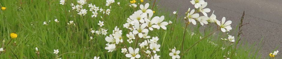
Going clockwise from the end of Court Wood Lane, the walk includes Frith Wood, Hutchinson Bank alongside Featherbed Lane, Crab Wood, then up to Little Farleigh Common where the first of three Coal Tax posts alongside a footpath reminds us of the longstanding semi-detached relationship with the City of London.
The route through Greatpark Wood takes us past the northern edge of what had been Warlingham Park Hospital, now a housing development. This was the mental hospital for Croydon Corporation and a reminder of the way what was sometimes perceived as unwanted land uses were often put at the edge or even beyond boundaries of a place.
 From Greatpark Wood, another two Coal Tax posts see us pass the Harrow Pub and then head north through Farleigh Common and up to the southern edge of Selsdon Woods.
- If you have a news story about life in or around Croydon, or want to publicise your residents’ association or business, or if you have a local event to promote, please email us with full details at inside.croydon@btinternet.com
 Inside Croydon is a member of the Independent Community News Network
- Inside Croydon works together with the Bureau of Investigative Journalism and BBC London News
- ROTTEN BOROUGH AWARDS: Croydon was named the country’s rottenest borough in 2020 in the annual round-up of civic cock-ups in Private Eye magazine – the fourth successive year that Inside Croydon has been the source for such award-winning nominations
- Inside Croydon: 3million page views in 2020. Seen by 1.4million unique visitors

Fascinating, a lot of hard work there. Now I know what to do on these nice sunny days. Thank you
Thanks Kevin, enjoy the sunnday day walks
This is fascinating and so well researched.
thanks David, helped keep me quiet during some lockdown evenings!
Wow, this is a fantastic article !
Boundaries have always fascinated me as well. Sometimes, the landscape on one side of a boundary is very different from that on the other, due to things that happened hundreds or even a few thousand years ago, in Medieval, Saxon, Roman or even Celtic times.
I think I am right in saying that the boundary between Sutton and Croydon, a line about 100 metres to the West of Purley Way from Russell Hill to Waddon Ponds area, is an ancient feature called the “Mere bank” which — according to some sources – lies on the alignment of the Roman Road from London via Streatham to Purley, Godstone and Lewes. I am also of that opinion.
The word “boundary” in Anglo Saxon is “Maerc” which must be “mark”. Quite likely, the word “mere” bank really means the “Mark or Maerc bank” , rather than the bank of a “mere ” or pond, although the Mere bank extended down to meet the Wandle at Waddon Ponds. Whether the springs there had been embanked by the local Cetic people to make a pond is dubious..
Boundaries are often marked by banks. If a Roman Road existed, which is usually a slightly raised road with a ditch on both sides, the Saxons wouid often use the line as the boundary. In a cultvated landscape, the road itself, with its gravel or stone core would be less attractove to ploughing, and might remain as a raised feature, enhanced naturally and/ or deliberately by trees and shrubs, right dwn to our own times.
The tragedy is that very few of these banks are designated as Ancient Monuments, with the exception of sections of Offa’s Dike, Wansdyke, various “Grims Ditches” and some others.
I am of the opinion that one can “feel” an approaching boundary, and know when the line has been crossed. I always get that vibe when driving down Long Lane towards Elmers end, or down the valley from the Addiongton Roundabout to Sparrow’s Den at West Wickham. Human settlements seem to pul back from such boundaries, as if sensing that these are places of change and difference, rather powerful. Places like Addington Village are gateway places– nearby the boundary is even called “Kent gate”. They seem aware that they are on the edge, a place of transition. There is a hidden agenda, denying the presence of places on “the other side” but perpetually aware of them.
.
At the risk of being reported to Pseuds Corner in Private Eye, I have no hesitation in saying that as I approach the Old Surrey/ Kent County Boundary, at all these places on Croydon’s border, I get distinctly anxious, uneasy feelings, then a strange sense of almost rebirth as I enter the new lands on the other side of the boundary. When I reach the first settlement beyond the boundary I can’t help being amazed that human life is here too, has heads, arms and legs, and is going about its day to day business, seemingly blissfully unaware that just half a mile away there is a space/ time discontinuity that I have just crossed in my Vauxhall Astra ! Weird!
Mysterious powers seem to conspire to limit the portals between places on opposite sides of ancient boundaries. To test this theory, I invite you to try to find routes in the Anerley / S Norwood / Elmers End area, and in Shirley West Wickham, other than the main roads, in an to attempt to get across the old County boundary, now the boundary betwen Bromley and Croydon.
I am confident that in most cases, you will drive down innocuous, promising- looking suburban roads that then turn a corner, to terminate in allotments, or loop back on each other, bringing you back to yoor strating pint, or hit a railway embankment. At the very least, you will go down a labyrinth of streets, and even if you find a way through, you may well end up traumatised, lost, confused, and somehow destabilised. Perhapos it is the old gods, playing their tricks on us.
Only “at home” when on the Surrey (Croydon) side of the line, although I have lived in Kentish exile in Beckenham, I have experienced that feeling many a time when seeking to find a linking road across the border in these areas. Not, you will understand, to rat-run down streets inhabited by the good, bave folk of the boundary lands, but to seek– like an explorer in strange lands– a crossing point across the old border.
Thanks , Dr. Clifford. I will try to summon up courage to walk the edge on your walks. Brllliant! But scary.
Thanks for the this detailed comment Lewis and I completely agree about the variety of ways the boundaries can still be marked. I found a few places around the old Addington boundaries (e.g. in Selsdon Woods and in Birch Wood) where there were still earth banks on the old bondary lines…
Having long been fascinated by the Borough and Parish Markers in Littleheath Woods and Croham Hurst, (perhaps I have been out too much) attempted to find out the relevance of the various dates recorded on the markers and become hopelessly confused, I can only congratulate you Ben on some great research. Thanks for sharing with us.
I’d long wondered the significance of the dates on the Littleheath Woods ones too, having seen them over many years, so was glad to be able to put the pieces together
Ben – Thank you for an interesting piece having been in Croydon on and off since 1966 there were even bits I was unaware of.
Thanks Ian
Just a minor point…the LCC marker on Streatham Common is a property marker to dissuade encroachment…..it marks the edge of the Common at a building line,and is the same as ones found on Clapham Common,Hampstead Heath etc.
The fact that this property line lies on the County Boundary 1889-1965 is entirely cd-incidental!
Thanks Nick, very happy to stand corrected on that one